The Shifting Scales of Western U.S. Landfalling Atmospheric Rivers Under Climate Change
We investigate how climate change may alter western U.S. landfalling AR characteristics and the nature of their precipitation (e.g., seasonality, storm-totals, and return periods). To do this, we utilize an AR detection algorithm (TempestExtremes) to identify ARs, classify them with the Ralph et al., 2019 AR impacts category scale, and project how AR characteristics may change under climate change using a set of variable-resolution Community Earth System Model simulations over 1985-2015 and 2070-2100, under a high-emissions (RCP8.5) scenario.
We highlight a systematic shift in “primarily beneficial” to “mostly or primarily hazardous” ARs with warming (i.e., +5 degrees Celsius across the coastal western U.S.), and under the most significant warming scenario a precipitation total increase of 4.6%/K is found, primarily due to AR contributed precipitation (+260%) rather than non-AR precipitation (+7%).
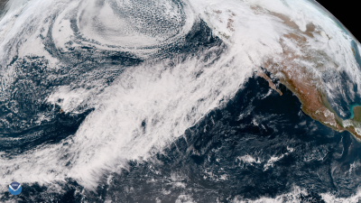
Atmospheric rivers are central to water resource management in the western U.S. Anthropogenic climate change has and continues to alter these storms, which has a cascade of societally relevant impacts. We evaluate how end‐century atmospheric river behavior is altered, assuming little‐to‐no carbon mitigation occurs. To do this, we use a state‐of‐the‐art global climate simulation, variable-resolution enabled Community Earth System Model (VR-CESM), that allows us to connect global‐to‐regional scales and, compared with conventional global climate models, better represent the interactions between atmospheric rivers and mountains when they make landfall. To isolate changes in atmospheric river behavior in our simulations, we use a newly developed atmospheric river detection algorithm and category scale devised to communicate risk more clearly. Using these tools, we find that by end‐century atmospheric river character shifts from being “mostly or primarily beneficial” to “mostly or primarily hazardous.” This results in increased precipitation totals, primarily from the most hazardous atmospheric rivers, resulting in sharpening and intensification of the water year. Some end‐century atmospheric rivers exceed the highest levels of the category scale; however, we do not find that any single storm produces significantly more precipitation. Therefore, the increased precipitation is due to an increase in the number of hazardous atmospheric rivers that more regularly occur back‐to‐back.

