Intensification of Hurricane Sally (2020) Over the Mississippi River Plume
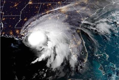
Hurricanes are among the most devastating weather systems, particularly when they intensify near coastal regions and make landfall, which presents grave danger to coastal inhabitants. In 2020, the slow-moving tropical cyclone (TC) Sally intensified rapidly from a tropical storm into a Category 2 hurricane just before making landfall near the Alabama coast. Typically, hurricanes that move slowly weaken because they spend a prolonged period over the ocean, which is being cooled by mixing caused by the storm, reducing the heat energy supplied to the storm. However, researchers have found that the freshwater from the Mississippi River plume acted as a barrier for the storm-induced mixing and sea surface cooling, ultimately aiding in Sally’s intensification.
Though previous studies have suggested the influence of various river plumes on TC intensification, the specific impact of the Mississippi River plume remained unexplored. This study offers substantial evidence, utilizing both observations and ocean model simulations to demonstrate that changes in the upper ocean conditions associated with the Mississippi River plume can favor the rapid intensification of hurricanes. This study also highlights the importance of incorporating salinity variations associated with the Mississippi River plume accurately to improve intensity forecasts for landfalling TCs in the northern Gulf of Mexico, which may offer more advanced warnings for people living near the coast.
The northern Gulf of Mexico is a region vulnerable to the impacts of TCs with potentially severe consequences for coastal communities, ecosystems, and economies. Hurricanes often travel over the freshwater discharge of the Mississippi River near the northern Gulf of Mexico. PNNL researchers investigated the impact of the Mississippi River plume on the intensification of Hurricane Sally, which made landfall on the US Gulf Coast in 2020. The study involved analyzing various ocean and atmospheric conditions that might have affected Sally’s intensification when it traveled over the Mississippi River plume. Examination of the prevailing atmospheric conditions did not adequately explain the rapid increase in Sally’s intensity. However, the subsurface oceanic conditions were favorable for TC intensification with deeper thermocline and strong salinity stratification. The analysis using satellite observations shows that a Loop Current eddy close to the river plume advected fresh water into the storm’s path, resulting in the development of strong upper-ocean salinity stratification with a shallow layer of freshwater lying above a deep, warm layer acting as a barrier. In-situ observations also confirm the sudden increase in salinity stratification by the Loop Current eddy. Experiments were conducted using a one-dimensional ocean mixed layer model to understand the influence of the barrier layer on Sally’s intensification, and the results indicate that without salinity stratification, the SST cooling would have increased significantly and may have instead potentially weakened the storm’s intensity. Ultimately, short duration events such as the advection of freshwater from river plumes can influence the condition of the ocean greatly, which can then affect hurricane intensification before making landfall.

