Impacts of the Morphology of New Neighborhoods on Microclimate and Building Energy Use
Global and regional climates are primary drivers of heating and cooling demand for buildings. The United States, comprising only 4.4% of the world's population, consumes 19% of the world’s primary energy production. In 2010, buildings accounted for the largest fraction (41%) of primary energy consumption. This fraction of consumption amounts to 40% of total US carbon dioxide(CO2) emissions, contributing significantly to global warming and to regional climate change. Climate change impacts, urban and rural population growth, and concomitant increases in energy demands have the potential to alter regional energy consumption patterns as more humans respond to new climate conditions. The added consumption may then result in even higher quantities of emissions that accelerate ecological change. This research demonstrates a process for creating and testing new neighborhood morphologies within a two-way-coupled mesoscale weather model for their impact on local and regional meteorology, and for allocating individual meteorological profiles to buildings in a neighborhood in order to run parallel computation of building-by-building energy use.
This research prepares the way for assessing future microclimate and building energy consumption using global climate projections as boundary conditions and incorporating impacts of population shifts and urbanization. It represents an important step towards quantifying and analyzing the relationships among climatic conditions, urban morphology, land cover, and energy use; and using these relationships to inform energy-efficient urban development and planning. Our Chicago Loop test case shows that the morphology of even a small new added development to a neighborhood affects not only its own microclimate, but also the microclimate of the original neighborhood to which the development is added and that these changes in microclimate affect both neighborhoods’ building energy use.
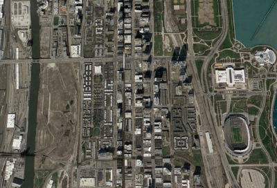
Researchers demonstrate a process for creating and testing example morphologies for new neighborhoods for their impact on local and regional meteorology within a two-way-coupled mesoscale weather model and allocating resulting building-level meteorological profiles to each building in a neighborhood for parallel computation of building-by-building energy use. To accomplish this process, five 1-year, four-domain (6k, 1k, 270m, 90m horizontal resolution respectively), nested meteorological simulations for 2015 were run using the Weather Research and Forecasting (WRF) model on the ORNL Titan and Eos supercomputers for two locations: one for the ORNL research campus and four for the Chicago Loop area. Urban terrain inputs (binary, readable by WRF) were generated using ORNL-produced shapefiles from LiDAR imagery and laser measurement and were included in the WRF simulations. The future neighborhood morphologies were generated using the concept of Urban Tissues, in which physical elements and relationships of the existing neighborhood are identified, subsetted, and recombined for the morphology of the new neighborhood. For each of the five meteorological simulations, building-specific meteorological profiles were defined at 90m resolution and used to initialize each building in massively parallel EnergyPlus building energy simulations. As mesoscale models are often coupled with Earth system models to understand regional impacts of large-scale systems under future scenarios, this methodology may be used further to understand global impacts and feedbacks from changes in climate and in urban terrain due to projected shifts in urban population and changes in urbanization.

