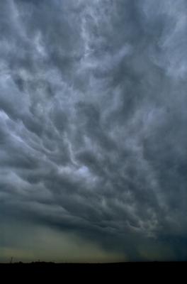
Where the Rains Come From
Intense storms have become more frequent and longer-lasting in the Great Plains and Midwest in the last 35 years. What has fueled these storms? The temperature difference between the Southern Great Plains and the Atlantic Ocean produces winds that carry moisture from the Gulf of Mexico to the Great Plains, according to a recent study in Nature Communications.
Understanding how storms changed in the past is an important step towards projecting future changes. The largest storms, especially, have been challenging to simulate.
Farmers and ranchers rely on understanding the timing, frequency, and amount of rain for survival of their businesses. Heavy rainstorms at the wrong time in a crop cycle can be devastating. Knowledge of routine cycles of storms and the amount of expected rainfall is essential for agricultural and municipal planning. Researchers in this paper found that understanding historical storm changes is an important step toward projecting future changes. Researchers are working to improve climate models so they can accurately capture these large and complicated rainstorms, for better understanding and planning.
The PNNL team worked out a way to identify storms called mesoscale convective systems. This type of storm develops from smaller convective storms that aggregate to form the largest type of convective storms on Earth. They are best detected using satellites with a bird's eye view from space. Feng transformed well-established satellite detection methods into a new technique that he then applied to rainfall measured by radars and rain gauges for the past 35 years. This allowed the researchers to identify thousands of the large convective storms and their rainfall east of the Rocky Mountains.
For more information, read PNNL news release Where the rains come from.
This research was supported by the U.S. Department of Energy Office of Science, Office of Biological and Environmental Research as part of the Regional and Global Climate Modeling Program.


